Abbagadassett Point
Reference River Flow: USGS Station Kennebec River: N. Sidney 38,000 cfs.
Time: 1151-1200 Low Tide at Chops: 10:25 High Tide: 16:40
Incoming tide, but flow still out.
Location: Abby Point
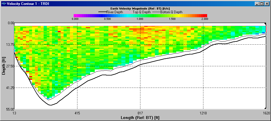
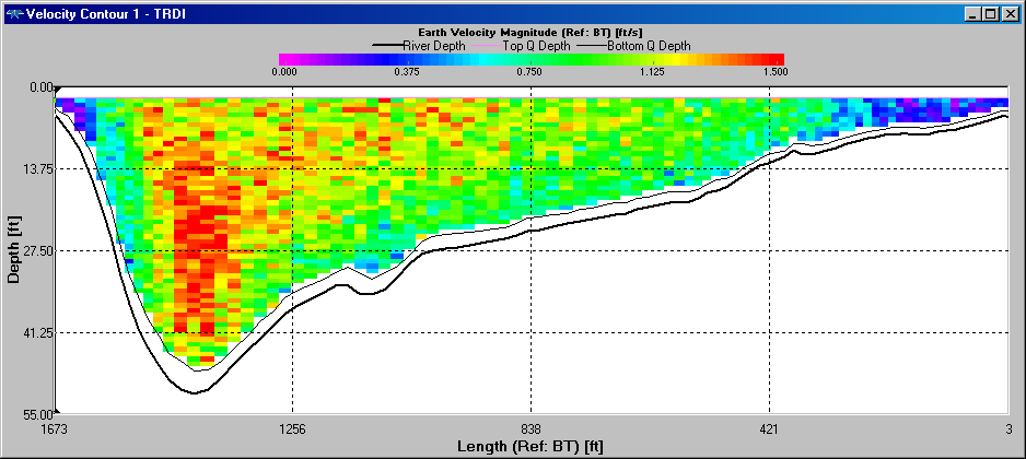
Transect: Ken@AbbyPt 001
Width: 1615 feet
Average Velocity: 1.56 feet/second
Notes: -3.7 feet to water surface from top of first stick when started transect
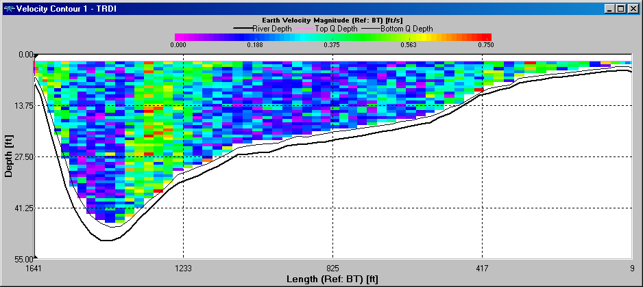
Time: 1250-1258 Incoming tide, but flow is still out. Even though flow is outgoing, water level here is rising because Chops cannot pass massive high flows fast enough.
Location: Abby Point
Transect: Ken@Abby_again_001
Width: 1,648 feet
Average Velocity: 0.03 feet/second
Notes: -3.0 feet to water surface from top of first stick when started transect
Time: 1300-1309
Location: Abby Point
Transect: Ken@Abby_again_002
Width: 1,658 feet
Average Velocity: 0.16 feet/second
Notes: -2.5 feet to water surface from top of first stick when ended transect
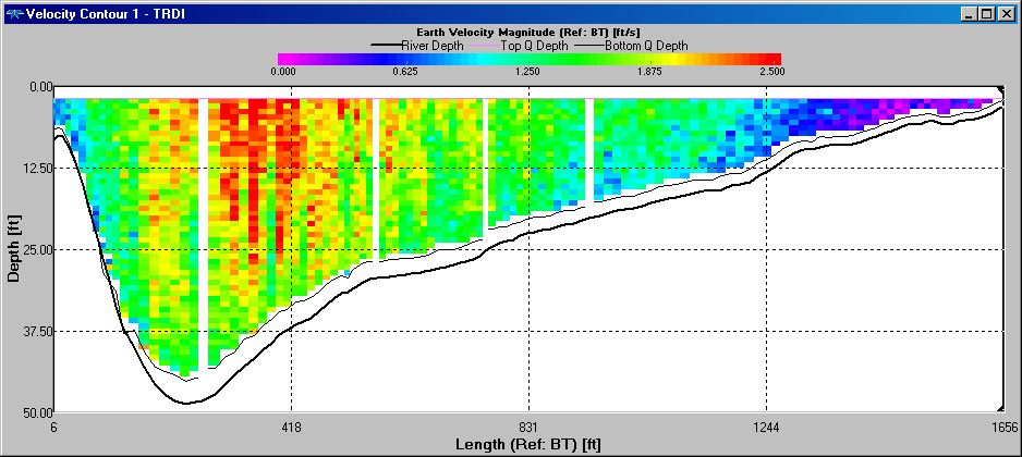
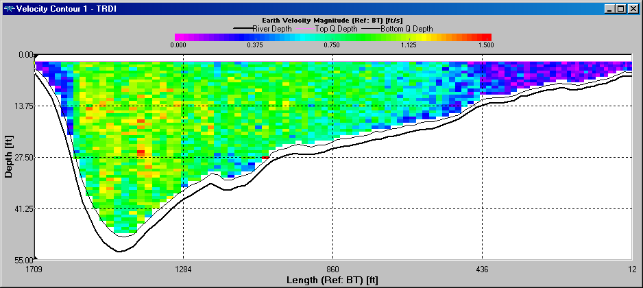
Time: 1405-1416
Location: Abby Point
Transect: Ken@Abby_again_003
Width: 1,743 feet
Average Velocity: 0.97 feet/second
Notes: -1.3 feet to water surface from top of first stick when started transect
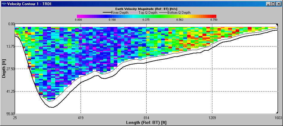
Time: 1514-1526
Location: Abby Point
Transect: Ken@Abby_again_004
Width: 1,770 feet
Average Velocity: 0.76 feet/second
Notes: -3.1 feet to water surface from top of second stick when started transect
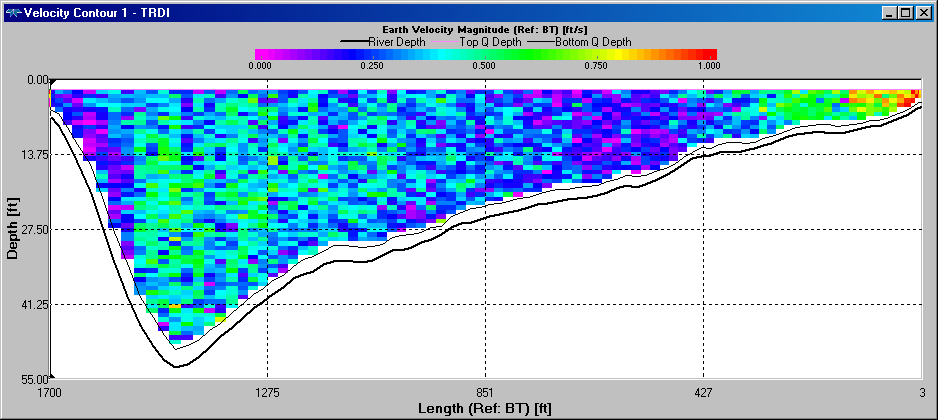
Time: 1600-1611, Almost high tide, but flow has never reversed.
Location: Abby Point
Transect: Ken@Abby_again_005
Width: 1,767 feet
Average Velocity: 0.19 feet/second
Notes: -2.5 feet to water surface from top of second stick when started transect
Time: 1722-1730
Location: Abby Point
Transect: Ken@Abby_again_006
Width: 1,784 feet
Average Velocity: 1.35 feet/second
Notes: -2.7 feet to water surface from top of second stick when ended transect